Rare earth deposits selected for mapping and exploration
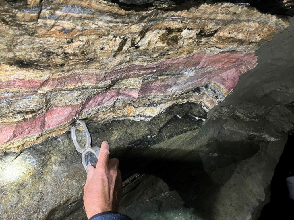
26.05.2023As part of the US Geological Survey (USGS) Earth Mapping Resource Initiative (EMRI), the USGS, in cooperation with the Montana Bureau of Mines, is conducting a high-resolution flyover, an aeromagnetic and aero-radiometric survey at the Sheep Creek, Montana property. Detailed geologic mapping and geochemical sampling will also be conducted to further define rare earth mineralization already identified.
 © US Critical Materials
According to the USGS: "The goal of Earth MRI is to improve our knowledge of the geologic framework in the United States and to identify areas that may have the potential to contain undiscovered critical mineral resources. Enhancement of our domestic mineral supply will decrease the nation’s reliance on foreign sources of minerals that are fundamental to our security and economy.”
US Critical Materials has previously announced that its Sheep Creek deposit has the highest reported total rare-earth oxide grades (TREO) of any rare earth deposit in the United States. Sheep Creek also has exceptionally low radioactive thorium, which will allow for more environmentally friendly extracting and processing.
US Critical Materials has nearly 9 % TREO (89,932 ppm), far ahead of any other domestic rare earth resource. The deposit also has readings of 2.4 % (23,810 ppm) combined neodymium and praseodymium, which are both essential for the green economy.
US Critical Materials president Jim Hedrick, a rare earth commodity specialist formerly with the USGS, stated: "The combination of high-grade rare earths, low thorium, and multiple carbonatites is a geological phenomenon that does not exist in other reported US deposits. Over the course of my career, I have never encountered a US property with the high rare earth grades being generated by Sheep Creek.”
Hedrick added: "The company’s geologists have discovered multiple carbonatites and believe there may be a common underground source for these carbonatites.”
The total claim block held by US Critical Materials is 7 square miles, which the USGS will help explore, map, and sample.
US Critical Materials welcomes the USGS and Montana Bureau of Mines and the cutting-edge geological and technical resources of the US Government.


